GUNUNG RINJANI
A Mount Rinjani trekking tour is not for novice hikers or casual travellers. But if you’re ready for an epic 3-day journey to the summit of the second highest volcano in Indonesia, here’s everything you need to know before you go.
 |
| Top of mount Rinjani |
At 3,726 metres above sea level, Mount Rinjani looms large over the entire island of Lombok in Indonesia. Of the 130 volcanoes in the country, Rinjani is the second highest (topped only by Mount Kerinci on Sumatra).
 |
| Lots of sticker from around the world coming for mount Rinjani |
Rinjani’s ominous silhouette is a constant reminder of the powerful forces rumbling just beneath the surface of the earth. That power is what draws hundreds of intrepid hikers to Rinjani every day.
 |
| SABAHAN BACKPACKERS OUTDOOR ADVENTURE TRIP APRIL 2018 |
This is a very active volcano. The oldest recorded historical eruption was in 1847. Previous to that this was a very remote region indeed, hence the lack of records.
There was a spate of activity from 1994 to 1995 which resulted in the further growth of the crater cone Gunung Baru, since renamed Gunung Barujari (meaning: Recently Completed Mountain in Sasak/Lombok native language).
On 27 April 2009 Gunung Barujari became active again with that activity continuing through to May 2009. The summit ascent routes were closed at that time as the eruptions intensified with plumes of smoke and ash as high as 8,000 m. A Volcanic Explosivity Index (VEI):2 rating was issued for the activity between May and December 2009. The ascent routes re-opened on September 14th 2009 but hiking routes down into the crater lake were still deemed unsafe and remained closed.
In February 2010 observers at the Gunung Rinjani Observation Post detected a smoke plume that rose 100 m from the volcano. The activity in early 2010 is centred about Gunung Barujari. On May 1st 2010 a column of smoke was again observed rising from Rinjani issuing eruptions 1,300-1,600 metres tall with thick brown color and strong pressure. On May 5th 2010 a possible ash plume rose to an altitude of 5.5 km (18,000 ft) and drifted 150 km NW. Accordingly the Center of Volcanology and Geological Hazard Mitigation advised that intermittent activity could produce ash plumes to 1,500 m (5,000 ft) above the caldera. In light of this The Volcanic Explosivity Index Alert Level was raised to 2 with a recommendation that there be no activity within a radius of 4 km from the eruption at Gunung Barujari.
 |
| Morning view from homestay Senaru |
 |
| paddy field |
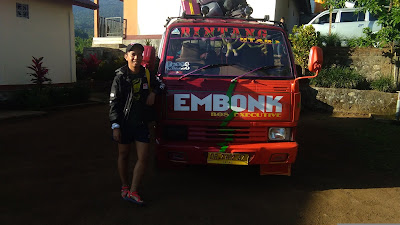
My first day, we staying at home-stay located at Senaru view mount Rinjani. our trip starting Sembalun end Senaru. Early morning all the hikers wake up early morning for breakfast before go to Sembalun gate by van.
 |
| Our transportation |
 |
| Onions |
If you opt for the 3-day, 2-night Rinjani trek starting in Sembalun, don’t let the first few hours fool you.
In the morning, the rolling ascent through grasslands is so gentle that a few motorbikes buzzed the trail, engulfing us with clouds of fine volcanic dust as they passed. It lulled into a false sense of confidence.
Sembalun is located on the steep slope of Mount Rinjani, in the north eastern region of Lombok Island, Indonesia. It is one of the gateway towns to trekking Rinjani. Sembalun is actually divided into two villages, Sembalun Lawang and Sembalun Bumbung. They are only two kilometers apart, and neither one is very big. So for this article, I will just talk about the two villages as one.
Most foreign visitors make their way to Sembalun to trek one of the highest mountains in Indonesia. But a number don’t even spend the night here, much less see the town. They typically stay in the neighboring town of Senaru, and then get transported here to access Rinjani. Technically speaking, Sembalun is closer to the some of the hiking trails to Rinjani than Senaru. It sits at a higher elevation above sea level. But why is Senaru getting all the trekkers? I can’t answer this question. It may be because trekking companies were first established in Senaru.
 |
| Porter bring all the food and tent atc. |
The tough hike to the crater rim is rewarded by absolutely magnificent views. Rocky black soil at the summit drops off into a lush valley filled with purples so deep and greens so bright they don’t look like they should exist in nature.
 |
| sleeping under this tree because inside the tent is so hot. |
 |
| Camping site |
DAY 2
At 3 am you’ll have a small breakfast with a hot coffee or tea before starting the last stretch of your climb to the summit. Mount Rinjani is the second highest mountain Indonesia, standing at 3,726 meters tall and is definitely an exciting climb. This mountain is also part of the famous ‘ring of fire’ which holds spiritual significance for the local people which are evident in the name ‘Rinjani’ meaning ‘God’ in old Javanese. As you make your way to the mountain you’ll pass through a steep ridge covered with sand and small rocks so tread carefully. The weather will also get significantly colder as get closer to the summit so be prepared to feel chilly and cold.
 |
| Summit attack |
Lake Segara Anak, nestled in the bottom of the gaping crater, is a deep turquoise, echoing the spectacular colour of Lombok’s seas.
On the edge of the lake sits an active volcano, Mount Barujari, which steadily spews threatening clouds of smoke into the air.
The typical Rinjani itinerary involves summiting in time for sunrise, early on the morning of the second day. The Rinjani summit stretches 1000 vertical metres above the first night’s campground.
Getting to the Rinjani summit for sunrise means getting up at 3am. It means hiking for four hours in the pitch dark. And the bitter cold.
Related: Don’t leave home without a headlamp!
When we left the beach on Lombok, it was 35 degrees Celsius. At the top of Rinjani, the temperature hovered around 2 degrees.
 |
| At almost 4,000m above sea level, the Rinjani summit is bitterly cold. |
The lower and mid levels of the mountain are quite heavily forested. Above the tree line though the slopes are barren and rugged scree slopes and volcanic rock. The views of the crater lake are quite breath-taking from the caldera rim, as is the sunrise. From the absolute peak you can see Bali to the west and Sumbawa to the east.
 |
| look in to my eyes |
The lower and middle elevation slopes are densely forested with typical tropical species, including species which occupy the Wallacea transitional region between the SE Asian and Australasian flora. Fig trees are especially apparent in the lower forests, as are the giant Syzigium Jambu, with the gnarled and epiphyte-hung Engelhardia Bak Bakan becoming prominent in the higher elevations. Casuarina woodland (cemara) takes over higher up and eventually these give way to an alpine flora above the treeline.
Lombok is East of the Wallace Line and some bird species with Australasian affinities are therefore apparent. These include honeyeaters, cockatoos and green hanging parrots, in addition to species whose heartland is to the West including tits, weavers and tailor-birds. Bird life can be difficult to observe here due to the density of the forest, though if you have patience and are practised at mimicry many species can be tempted out from cover - if you have the time to spare and the forebearance of your trekking partners.
The familiar long-tailed grey macaque (the Bali temple monkey) is common right up to the crater rim. Of much more interest is the rare ebony leaf monkey which inhabits these forests and whose soft hooting contact call often provides a soothing backdrop to the birdsong. Rusa deer and muntjacs are more often heard than seen.
 |
| this flower is beautiful Edelweiss |
Rinjani Mountain was the forest mountain way‚ but it has millions beautiful panorama‚ started from the amazing forest‚ Waterfall‚ and until the lake of Segare Anak. If we talk about Rinjani‚ we need so many times to do it. One thing that you could not to forgot if you hiking or traveling to Rinjani Mountain‚ There was a beautiful Edelweiss Ala Rinjani.
Rinjani Mountain safe many beautiful panorama‚ Started from rinjani mountain itself‚ lake of Segare Anak‚ and the waterfalls among the mountain until the amazing forest there. Edelweiss was one part of the beautiful panorama would find out if you go to Rinjani Mountain. It’s exactly made Rinjani Mountain as a place to saw Edelweiss in Indonesia‚ Besides in Tegal Alun (Papandayan Mountain) ‚ Alun- Alun Surya Kencana and Mandalawangi (Gede Pangrango Mountain). Edelweiss itself was some kind of flower‚ In Latin language‚ it named Anaphalis Javanica. It could grow up especially at mountain or the highest mountain‚ the thousand meter from the sea‚ It usually has a little flower and white‚ The drying flower of Edelweiss can life for long time‚ It caused Edelweiss as a symbol of immortality. For a couple‚ it was be favorite flower‚ because if you bring those flower and you gave to you honey or boy/girlfriend‚ it could make your pair be surely with your love. If you did not believed‚ let’s tried…!!!
 |
| Monkey at the top of mount Rinjani |
 |
| Segera Anak Lake from top mount Rinjani |
DAY 3
After 3 hours, you’ll have arrived at Mount Rinjani’s summit! Feel accomplished as you arrive at your destination and savour the beautiful view of the ocean as it stretches out to Bali Island. Watch as the first ray of light of the day touches the Segara Anak Lake, creating the most breathtaking sight that you’ll want to capture with your camera. Then head back to the campsite for a more filling breakfast as a reward for achieving your goal of completing the three days hike to the summit. After breakfast, you’ll go down to Segara Anak Lake which should take around 3 hours where you’ll be surrounded by the towering mountains and verdant greenery as you overlook a gorgeous lake. Soothe your aching muscles at the hot springs and relax your body in the soothing warm waters after a tiring day before sleeping at the campsite set up at the lake.
 |
| River at Segera Anak Lake |
 |
| Mount Barujari view from Segera Anak Lake |
 |
| the large sign bord at Segera Anak Lake |
 |
| Camp site beside the 6 Waterfalls and hot water pool |
 |
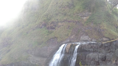
| Waterfalls |
The lake was totally still and the only movements you could perceive were the vibrations generated each time a fishing lens would pass the interface between the air and the water making an audible “tic!”.
This text first appeared on "Nomad Travellers". Read more on: http://www.nomadtravellers.com/travel-advice/hot-springs-rinjani-lake-segara |
| local fishing at Segera Anak Lake |
DAY 4
Have breakfast then trek to Plawangan Senaru through a steep path where you should walk with caution. We will stay one night at Senaru forest.
DAY 5
Morning wake up, brekfast then continue decent..
From Senaru gate you’ll go to Senaru Village which will take about four hours on foot and then you’ll be transferred to Mataram or Senggigi to mark the end of your trip.
 |
| Nyaman!! |
DAY 5
Morning wake up, brekfast then continue decent..
 |
| forest |
From Senaru gate you’ll go to Senaru Village which will take about four hours on foot and then you’ll be transferred to Mataram or Senggigi to mark the end of your trip.
Trip continueeee.... to Gili trawangan


